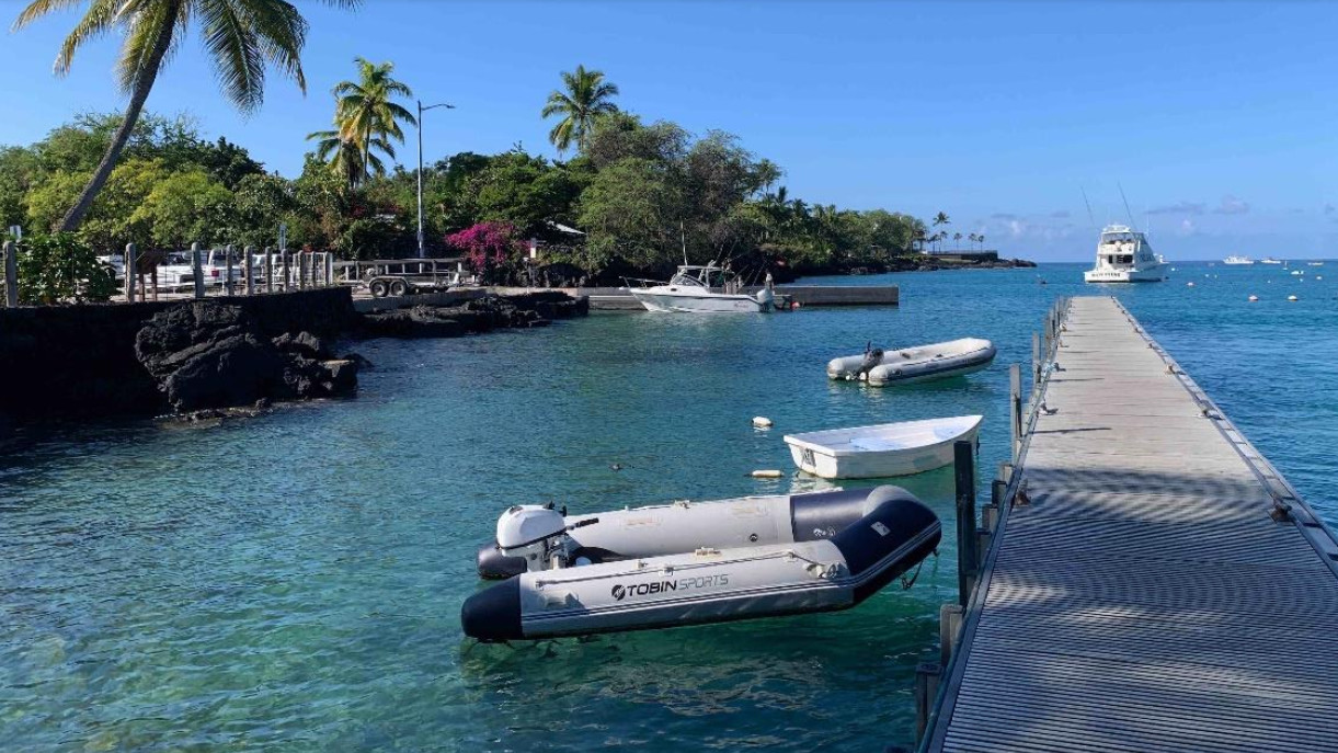
Photo of DOBOR Pier at Keauhou Bay (from the draft Environmental Impact Statement)
(Bibim) The draft Environmental Impact Statement for Kamehameha Schools’ Keauhou Bay Management Plan is published in the latest issue. Environmental Notice.
The plan covers approximately 29 acres of land in Keauhou Bay in North Kona and proposes “reorganizing commercial activity away from culturally sensitive areas to reduce congestion and establish a new community-based cultural education center.”
From the draft EIS:
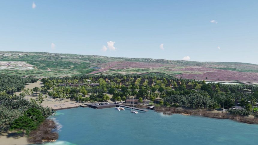
Keauhou Bay is a small bay along the Kona coast (Figure 1-1) traditionally known as the home of the Alii (chiefs) and as a place of recreation such as holua sledding and surfing. Keauhou Bay is best known as the birthplace and resurrection site of ka moi (king) Kauikeaouli Kaleiopapa Kuakamanolani Mahinalani Kalaninuiwaikua Keawe’aweulaokalani (Kamehameha III), son of Kamehameha Ekahi (Kamehameha I) and Keopuolani. Today, kama’aina (native people born at the site and still living there) and visitors recognize the historical importance of Keauhou Bay as the birthplace of this important Hawaiian leader while also enjoying the area as a popular seaside recreation, residential, and resort destination.
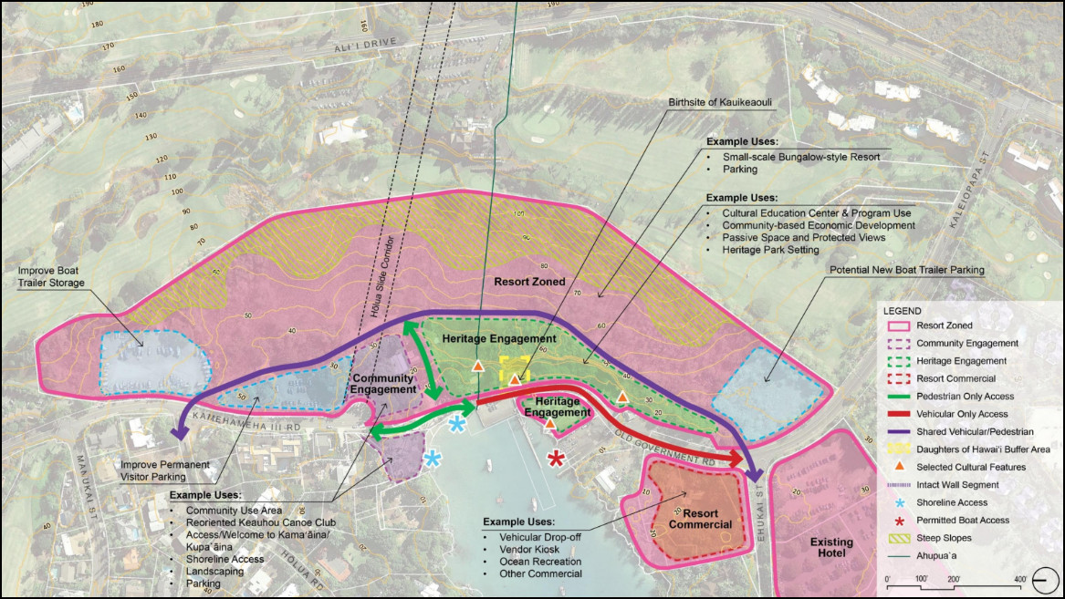
Keauhou Bay Conceptual Use Map (from the draft Environmental Impact Assessment Report)
New “low-impact lodging facilities located on the plateau mauka of the Bay Resort Zone” are also part of the planned reconfiguration.
The draft Environmental Impact Statement can be downloaded in two files. Volume 1 and Volume 2.
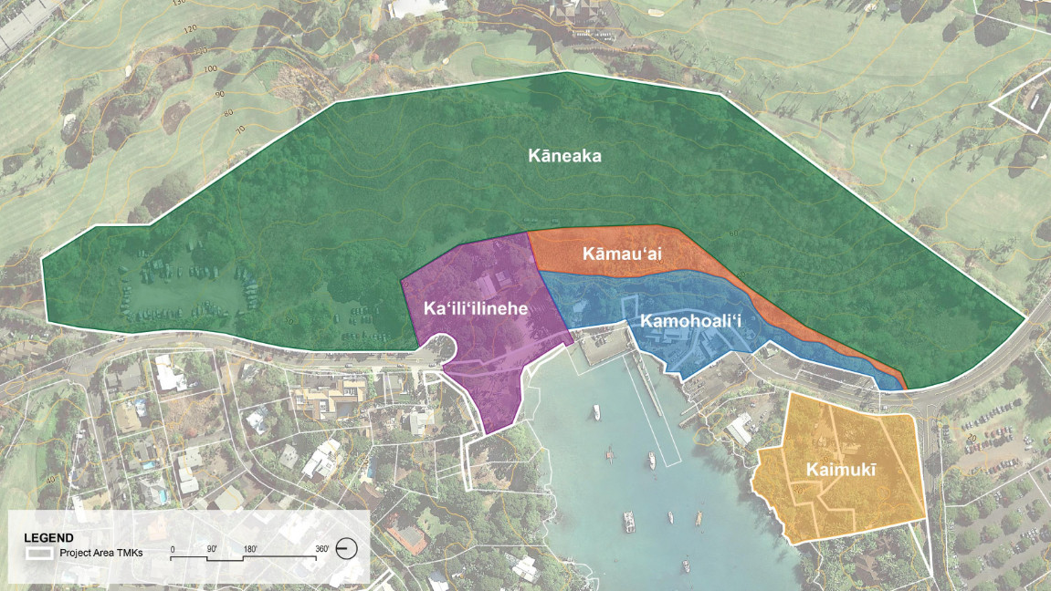
Map showing five Kamehameha Schools designated land planning areas in Keauhou Bay (from the Draft Environmental Impact Statement).
The management plan envisions five Kamehameha Schools designated land planning areas in Keauhou Bay: Kaneaka, Kaililinehe, Kamaua’i, Kamohoalii and Kaimuki.
The proposed actions are outlined in the opening 438-page volume of the draft Environmental Impact Statement. According to Kamehameha Schools, the plan will be driven by five key management strategies:
A. Establishment of Heritage Management Corridors
- Existing commercial activities adjacent to the birth area will be relocated and existing facilities will be reused for cultural and educational activities.
- Protect the cultural sightlines and views from the birthplace area and the “Ahu’ula Cliffs”.
- Follow the footpath from the present-day birthplace area to Moikeha Cave.
- Maintain buffer zones and open space corridors within the Kaneaka Hōlua Path alignment.
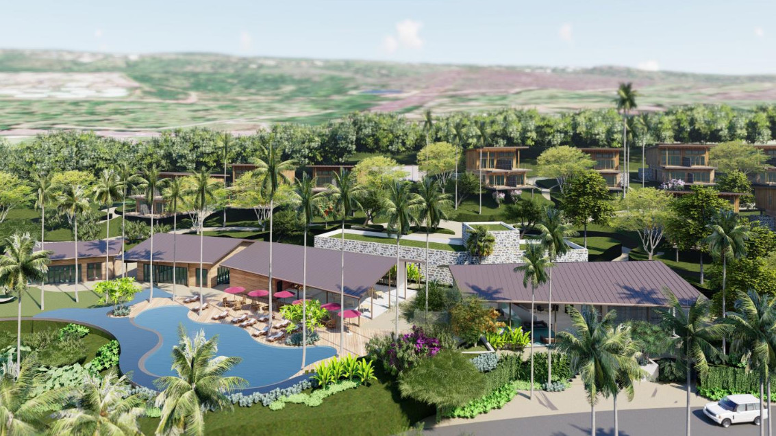
Rendering of the proposed Kaimuki Retail Center as seen from Makai of the Bay (from the draft environmental impact statement)
B. Repositioning and development of a new commercial bayfront area and a resort area of appropriate density
- The development will involve several low-rise buildings containing a total of approximately 14,000 square feet of retail and food and beverage space to accommodate the relocation of commercial operators from the Bay Area, complementary retail uses, and provide space for existing marine recreation operators that currently do not have a physical presence or official check-in location.
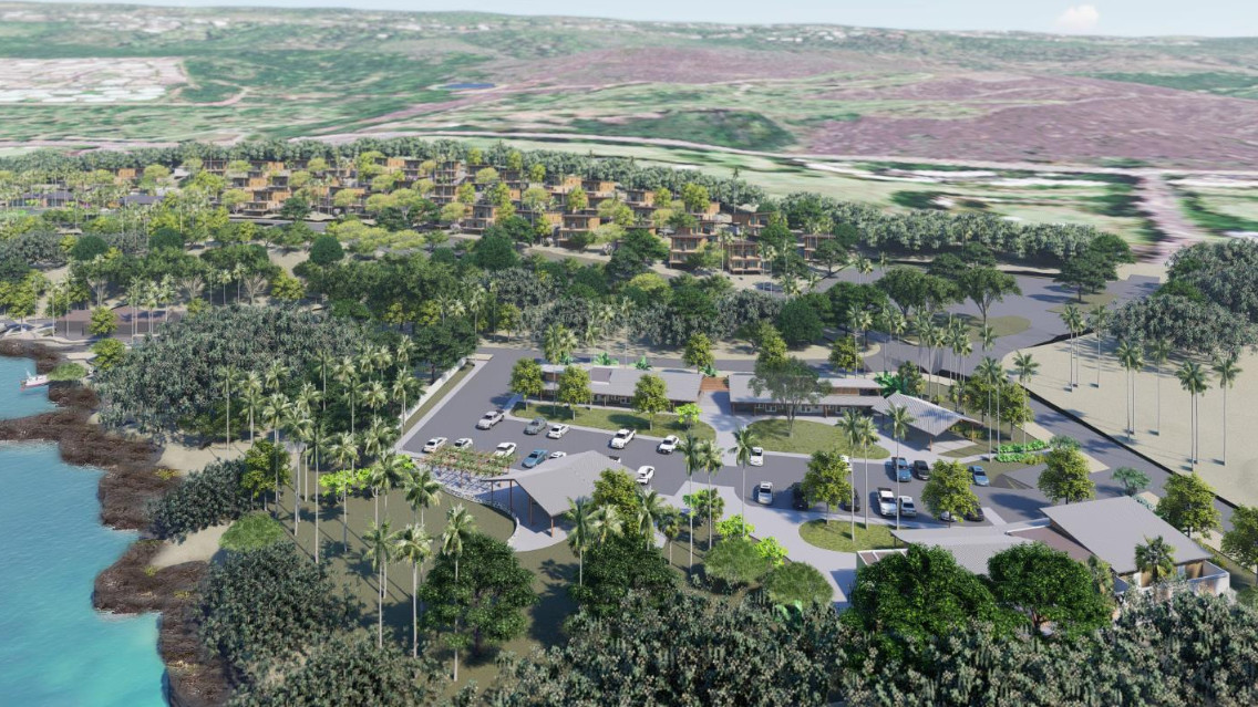
At the bay. - Addresses opportunity gaps within Kona’s existing visitor accommodation inventory by providing a well-defined density of low-impact lodging on the upper mauka plateau of the Ahuula Cliffs.
Renderings of the hotel lobby building with minimal environmental impact from the draft environmental impact assessment report
C. Redirecting recreation and community use
- Reorganize the area of use by the Keauhou Canoe Club and reorganize the scope of official and informal recreational use of the area.
- A new 200-foot-wide open space corridor will run maukamakai from Old Kona Road and the upper Ahuula Cliffs overhang to the beachfront.
- Expand Kaili’ilinehe Beach Park to connect to the mauka makai corridor.
- A parking lot for recreational users will be constructed on the north side of Kamehameha III Road.
- A pedestrian-only trail will be installed along Old Kona Road and passive open space will be maintained along the top of the Ahuula Cliffs Plateau.
- Establish a future community use area adjacent to the Keauhou Canoe Club.
- Improve access to the coast for cultural and recreational activities.
- and increasing inclusivity in the Gulf region.
D. Maintain existing and establish new areas of community-based cultural education
- An existing building adjacent to the birth area will be repurposed to become part of a cultural learning centre and heritage centre.
E. Manage vehicle, boat and pedestrian circulation through Bayfront Village.
- Provide improved and accessible parking for recreational users, local residents and area visitors.
- It will revitalize Old Kona Road, easing congestion on the bayfront and providing a north-south connection.
- Work with the state Department of Land and Natural Resources (DLNR) Division of Boating and Marine Recreation (DOBOR) to explore additional parking for in-use boat trailers.
- Consider an agreement with DOBOR and the County of Hawaii to manage vehicle loading and unloading operations at the pier and adjacent facilities.
- Create new wayfinding throughout the area, including landscaping, signage, reflection points and entry features.
The statutory 45-day public review and comment period on the Draft Environmental Impact Statement is ongoing. Comments are due by August 7, 2024.