“If you’re an average citizen of a coastal city, you have to understand what the elements of vertical land movement do, even from one district to the next, and how that increases the likelihood of flooding. I think it’s important to understand how to change that,” said Brett Buzanga. lead author of the study and a coastal scientist at NASA’s Jet Propulsion Laboratory.
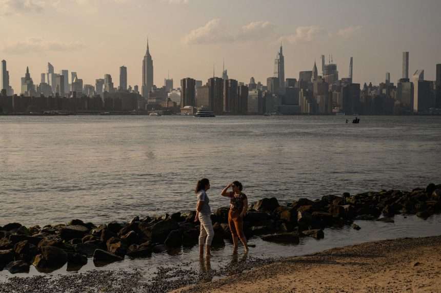
By comparison, a few millimeters of ground subsidence in New York City may seem trivial, but flooding could worsen as sea levels rise. Over the past 20 years, sea levels have risen 4.4 millimeters a year in Manhattan, some of which is due to land subsidence, the study says. If extreme weather events occur, this can have significant consequences. One study estimated that The approximately $8 billion in damages caused by Superstorm Sandy in 2012 can be linked to sea level rise.
“If the sea level is high and the land is low, more damage can occur,” Buzanga says. “It just kind of exacerbates the background conditions that these storms operate on. There’s more water flying around.”
Buzanga and his colleagues employed a new technique using satellite data to obtain high-resolution measurements and compare neighboring areas. This research improves GPS data from ground instruments and airplanes that can collect high-resolution data point by point.
“We have learned so far that there are differences across the region and that some points may subside faster than others, which may cause further flooding in some points. “We’re highlighting more details than ever before,” Buzanga said. “This would be the same in any city.”
New York is one of several coastal cities experiencing significant land subsidence. According to other studies, For example, Norfolk and Virginia Beach are sinking more than 3.5 millimeters per year on average. In some areas around New Orleans, Subsidence of 40 mm per year.
Land can sink for several reasons. In New York City, much of that can be related to glacier retreat from the last Ice Age, when ice sheets added weight to the land beneath areas such as the northeastern United States, causing the Earth’s crust to stretch and deflect. . But New York City was on the fringes of a sagging region that was rising upwards. As the ice sheet began to retreat, the land slowly began to flatten, saggy areas began to rise, and bulging areas began to sink.
Think of this change like pushing down on a balloon with your finger (acting as an ice sheet) and then lifting it up (retreating the ice sheet).
However, human activities place extra stress on our land and can cause it to sink or rise beyond these deep natural processes. The study found that sinkhole hotspots at LaGuardia, Arthur Ashe Stadium, and along some roads were once landfill sites. Buzanga said these sites “will be compressed much faster than those built on a more solid foundation.””
Arthur Ashe Stadium was renovated with a special lightweight roof to reduce subsidence.
The survey also found some unexpected areas where the land is uplifted. For example, in Brooklyn, Newton Creek east of Williamsburg was uplifting by about 2 millimeters per year. The study notes that the area is undergoing a major civil engineering project to recover and treat contaminated groundwater from the Creek aquifer, which could result in land uplift. However, land uplift can also destabilize infrastructure.
Tom Parsons, a U.S. Geological Survey geophysicist who was not involved in the study, said he was impressed with the resolution of the subsidence and uplift data the authors produced.
Their conclusion is consistent with Parsons and colleagues’ previous findings that infrastructure built on top of artificial embankments at or near the coast appears to sink at a higher rate.
The study confirms the usefulness of satellite data to “help major cities manage multiple issues, including where to construct large buildings, use artificial fills, and where protection measures against future flooding are needed.” Mr. Parsons said.
Stephen Dhondt, a professor of oceanography at the University of Rhode Island who was not involved in the new study, added that subsidence at sites built on reclaimed land: This can be exacerbated by the weight of buildings and runways. However, it is not the main cause of land subsidence, as the subsidence caused by this increased weight of infrastructure typically stops within a few years after construction.
Buzanga said he and his colleagues plan to use a newly developed algorithm to make such vertical displacements. Available data This could help inform local flood risk and urban planning.
“Any city in the world would benefit from such sophisticated analysis of vertical land movement across the city,” Dhondt said.